Ever tried to follow your GPS and still ended up taking the long way? Or worse, missed your turn on a road trip when the map briefly went quiet. That can feel weird, because GPS seems like it should be perfect.
Here’s the simple truth: GPS is a satellite timing system. Your phone or car listens to signals from space, figures out exactly where you are on Earth, and then helps you choose a route.
This guide breaks GPS down step by step, using plain language and real-world examples. You’ll see the main parts, how signals turn into distance, and how the math pins your position. Then we’ll cover common errors, why GPS usually still works well, and what’s new in 2026. After that, you’ll never look at your maps app the same way.
Meet the GPS Dream Team: Satellites, Stations, and Receivers
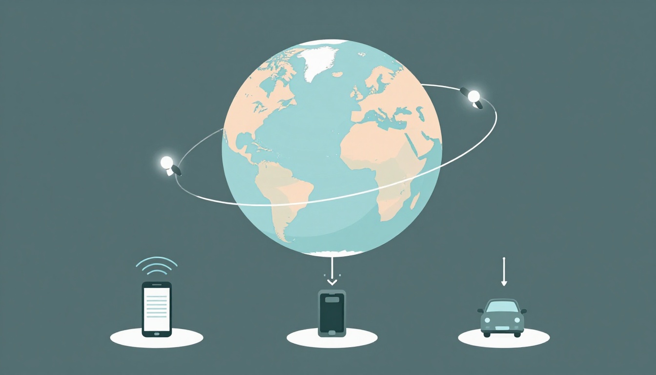
GPS works because three groups do their jobs together. Satellites broadcast signals. Ground stations keep those signals accurate. Receivers, like in your phone or car, listen and compute your position.
If you want a quick behind-the-scenes view, this explanation of how GPS knows where you are is a helpful reference: How GPS Knows Where You Are.
Satellites High Above: Constantly Broadcasting Your Clues
GPS satellites act like space beacons. Each one sends a radio signal with two key things: the time it was sent and an ID code. Your receiver uses those details like clues in a mystery.
Since GPS satellites orbit in predictable paths, your device knows where to look. Also, the time comes from atomic clocks, which stay extremely accurate. That matters because GPS turns time into distance.
Think of it like this: in a dark room, friends shout where they are and when they shouted. You don’t “see” them, but you can still calculate where you stand by comparing those shout times.
Ground Stations: The Unsung Heroes Keeping It Accurate
Satellites don’t stay perfect on their own. Tiny timing drifts and small orbit shifts can build up. That’s where ground stations help.
Around the world, ground stations track satellite signals and monitor their orbits. They then upload updates to correct timing and orbit data. In other words, ground stations keep the satellite “clues” reliable.
You might not notice this part, but it explains why GPS usually gives dependable results. Without those updates, your receiver would be working from older, less accurate info.
Receivers in Your Gadgets: The Location Calculators
Your GPS receiver is the brains in your pocket. It listens for signals from multiple satellites at once. Then it measures the signal travel times and calculates where you are.
To do that well, you usually need signals from four or more satellites. That’s why a clear sky helps. Trees, buildings, tunnels, or parking garages can block signals and reduce accuracy.
Once your receiver has enough distances, it runs the math. The math part feels scary, but it’s basically “distance from clues,” repeated until your spot is nailed down.
From Orbit to Your Screen: Tracking Signals and Distances
GPS navigation starts with one simple idea: time and speed. Radio signals travel at the speed of light. So, if your receiver knows exactly when a satellite sent a signal and when it received it, it can calculate distance.
Here’s a clear way to think about it. Your receiver compares timestamps from different satellites. Each satellite gives a different distance value, because each signal traveled a different path length.
For more background on the core timing idea, Britannica has a straightforward explanation: How Does GPS Work?.
Step 1: Signals Go Out From Satellites
Each GPS satellite broadcasts a radio message nonstop. That message includes:
- A unique satellite code (so the receiver can tell which satellite it is)
- The precise send time from the satellite clock
Your receiver doesn’t need your surroundings. It just needs to hear the signals clearly.
Step 2: Your Receiver Measures Tiny Delays
Next, your receiver estimates how long each signal took to arrive.
This delay is unbelievably small. Still, atomic clocks and careful design let GPS measure those slivers of time. Then the receiver converts delay into distance.
Step 3: Distance Equals “Speed Times Time”
Because radio waves move at the speed of light, distance is:
- Distance = speed of light × travel time
That gives you a distance to each satellite. For navigation, those distances are the raw ingredients.
Why precise time is everything
If time is off, distance is off. Even a small clock error can shift the position result by a lot.
That’s also why GPS relies on multiple satellites. The receiver can solve for your location and correct for small receiver clock errors at the same time.
Trilateration Magic: How Circles in Space Nail Your Position
People often say GPS “triangulates,” but the common idea is slightly different. GPS primarily uses distances, not angles. The technique is called trilateration.
To picture it, imagine your position as the point where spheres overlap. Each satellite’s distance forms a shape in space around you. Where the shapes intersect is your location.
For a teacher-friendly walkthrough that shows the geometry clearly, check Trilateration | GPS.gov.
One Satellite: A Giant Sphere of Possibilities
With one satellite, you know only one thing: you’re that many miles away from it.
In 3D space, all points at that distance form a sphere. That’s a lot of possible locations, so one satellite can’t pin you down.
Two or Three Satellites: Narrowing to a Spot
With two satellites, you get two distance constraints. The spheres overlap, and the overlap becomes a circle.
With a third satellite, the circles narrow to two intersection points in space. At this stage, Earth’s shape and your likely altitude help choose the real answer.
So the receiver keeps tightening the location until only one realistic spot remains.
Four or More: Locking in Latitude, Longitude, and Altitude
That fourth satellite (and more) improves the fix. It also lets the receiver solve a timing mismatch in its own clock.
Once the receiver gets enough satellite distances, it can calculate your position in three parts:
- Latitude (north-south)
- Longitude (east-west)
- Altitude (height), when supported
In practice, GPS often uses six or more satellites when signals allow. That improves reliability and helps accuracy in real places.
GPS Hiccups Exposed: Errors and Clever Fixes
GPS is strong, but it’s not magic. Signals can get affected by physics, obstacles, and small timing shifts. The good news is GPS systems plan for those issues.
Most errors come from a few common sources:
- Clock or orbit drifts (fixed with ground updates)
- Atmosphere delays (fixed with models that predict signal slowdowns)
- Multipath reflections (fixed by better antennas and signal processing)
- Blockage and weak sky view (fixed by moving to a better spot)
Here’s a deeper look at why corrections matter in GNSS systems: GNSS Corrections Demystified.
Atmosphere: the air slows signals a bit
GPS signals pass through the ionosphere and troposphere. Those layers bend and delay the signals slightly. So the receiver uses correction models to reduce that bias.
Multipath: signals bounce before arriving
In cities, signals bounce off buildings, walls, or parking structures. Your receiver might hear a main signal and one or more reflected copies.
Modern receivers try to pick the cleanest signal path. They also use multiple satellites to average out weird reflections.
Blockage: if you can’t see the sky, accuracy drops
If you’re under thick trees, between tall towers, or inside a parking garage, fewer satellites get line of sight.
That’s why GPS can “lock” quickly outdoors but struggle indoors. Still, it often works well enough for turn-by-turn driving.
Augmentations that boost accuracy
For higher-precision needs, systems use extra correction data. Examples include wide-area services (often called WAAS in the US) and other correction methods.
And newer setups can combine multi-GNSS signals. When GPS teams up with other satellite systems, your receiver can find more usable satellites, which improves reliability.
GPS Powers Your World: Navigation and Cool Everyday Uses
GPS is more than a route line on your screen. It helps devices estimate location, speed, and time. That means it can power tasks that feel ordinary, but run on real calculations.
For a practical look at GPS’s uses in daily operations, this overview is useful: What Is GPS and how do GPS systems work?.
Here are common ways you’ll run into GPS:
Turn-by-turn driving is the obvious one. GPS also helps apps estimate travel time by watching speed changes over distance. That’s why traffic detours can appear quickly.
Fitness trackers use GPS to map runs, rides, and hikes. They can estimate pace because location updates keep coming at steady intervals.
Family tracking and car tracking depend on location history. Some systems work even when you’re not constantly checking your phone. Meanwhile, fleets and service teams use GPS to know where vehicles are and how far they are from the next job.
Finally, GPS supports offline navigation. When your map data is saved, your phone can still guide you using satellite fixes, as long as it can keep enough signals.
GPS in 2026: New Signals, AI, and Super Accuracy
By March 2026, GPS improvements are getting more visible. Two big themes stand out: stronger satellites and smarter ways to handle interference.
The US Space Force keeps rolling out the next generation. As of early 2026, the ninth GPS III satellite launched on January 27, 2026. GPS III satellites are designed to be three times more accurate and send much stronger signals than older ones. The tenth GPS III satellite (SV-10) is planned for launch no earlier than late April 2026.
Stronger signals matter because interference is a real risk. Newer satellites also support better anti-jam features, making it harder for someone or something to overwhelm the receiver.
Multi-GNSS for better coverage
GPS doesn’t have to work alone. Receivers often pull signals from other satellite networks too, like Galileo and BeiDou. That helps in tougher spots, such as dense cities where one system might have weaker coverage.
AI support for interference problems
AI-based tools can help detect jamming or spoofing patterns. Then the system can respond faster. That can improve safety for vehicles and critical services.
Super-accurate positioning for advanced uses
Some systems now aim for centimeter-level precision using advanced corrections and timing. That can help robotics, construction, and high-precision mapping.
In addition, low-Earth orbit concepts and related approaches can support tighter timing updates. The result is finer position estimates, especially when you combine corrections and good satellite visibility.
All of this adds up to one practical change: GPS works better in more places, and it gets steadier over time.
Conclusion: GPS is timing, distance, and smart fixes
Remember the simple story. GPS is a team effort between satellites, ground stations, and your receiver. Satellites broadcast precise time and codes, and your device converts signal timing into distances. Then trilateration narrows those distances into a specific latitude, longitude, and (when supported) altitude.
Even when things go wrong, GPS stays reliable because it uses models, updates, and corrections. And in 2026, stronger signals, multi-GNSS support, and AI help the system handle interference better.
Next time your route line updates after a wrong turn, pause and appreciate what you’re actually seeing. GPS is fast geometry powered by careful timing, working in the background the whole time.
What’s the most memorable moment you used GPS to avoid getting lost? Share your story in the comments.